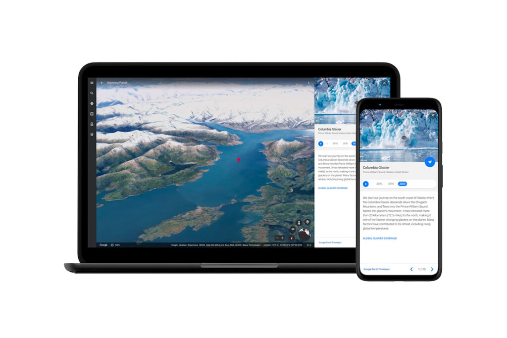
Google Earth for the last 40 years has been using satellite technology to give us a 3D time-lapse video of our planet. Writing on their blog, Google wrote, “you can now see our planet in an entirely new dimension — time.”
Google partnered with NASA, the Us Geological Survey and European Space Agency’s Copernicus programme to collate images. This is layered with “data of more than 24 million satellite images from 1984 to 2020” according to Google Earth’s director of Earth Engine and Outreach Rebecca Moore.
What’s the reason for this advanced update? Moore continued that Google Earth hope to provide governments, researchers, publishers, educators and advocators “a light on the issues facing our planet.” The videos show the harsh reality of deforestation, mining, infrastructure and global warming in a way we’ve never seen before.
Launching the feature is easy as well. All you have to do is go on Google Earth, click the wheel icon and you’ll be directed to “Time-lapse”. You can also watch an in-depth directory of more than 800 videos, for those who aren’t sure where to start in the world.
Have a look around the world from Dubai to Brazil here.
[Image Source: Google]